
Last Updated on: 28th October 2022, 05:21 pm
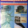
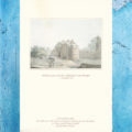
2006 SANTAREM (BRAZIL) PORT GUIDE
P & O CRUISES
P&O COLLECTABLES | BRITISH |
CRUISING / CRUISES | BRAZIL / BRAZILIAN
COLLECTABLES | PORT GUIDES
NAUTICAL | CRUISE SHIPS | OCEAN LINERS |
LEISURE | LIFESTYLE | CULTURE |
TRAVEL | HERITAGE | HISTORY
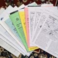
DETAILS:
MEASUREMENTS:
Approx. 8 1/4 inches x 11 3/4 inches
This is a single bi-fold sheet leaflet
MAKER’S / PUBLISHER’S MARKS:
P&O CRUISES
TEXTS:
Some excerpts…
CONTENTS:
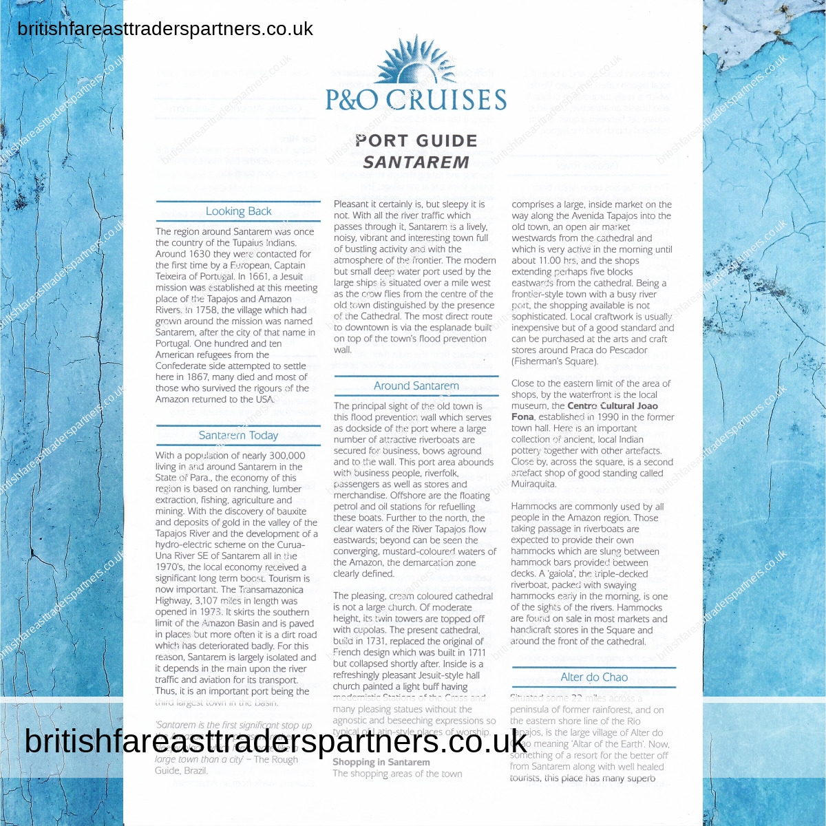
1. LOOKING BACK
The region around Santarem
was once the country of the Tupaius Indians.
Around 1630 they were contacted for the first time
by a European, Captain Teixeira of Portugal.
In 1661, a Jesuit mission was established at this meeting place
of the Tapajos and Amazon Rivers.
In 1758, the village which had grown around the mission
was named Santarem, after the city of that name in Portugal.
One hundred and ten American refugees
from the Confederate side attempted to settle here in 1867,
many died and most of those who survived
the rigours of the Amazon returned to the USA.
2. SANTAREM TODAY
With a population of nearly 300,000
living in and around Santarem in the State of Para.,
the economy of this region is based
on ranching, lumber extraction, fishing, agriculture and mining.
With the discovery of bauxite and deposits of gold
in the valley of the Tapajos River
and the development of a hydro-electric scheme
on the Curua Una River SE of Santarem all in the 1970’s,
the local economy received a significant long term boost.
Tourism is now important.
The Transamazonica Highway,
3,107 miles in length was opened in 1973.
It skirts the southern limit of the Amazon Basin
and is paved in places but more often it is a dirt road
which has deteriorated badly.
For this reason, Santarem is largely isolated
and it depends in the main upon the river traffic
and aviation for its transport.
Thus, it is an important port
being the third largest town in the Basin.
‘Santarem is the first significant stop up the Amazon.
It is a pleasant rather sleepy place
which feels more like a large town than a city –
The Rough Guide, Brazil.
Pleasant it certainly is, but sleepy it is not.
With all the river traffic which passes through it,
Santarem is a lively, noisy, vibrant and interesting town
full of bustling activity
and with the atmosphere of the frontier.
The modern but small deep water port
used by the large ships is situated over a mile west
as the crow flies from the centre of the old town
distinguished by the presence of the Cathedral.
The most direct route to downtown
is via the esplanade built on top of the town’s flood prevention wall.
3. AROUND SANTAREM
4. ALTER DO CHAO
5. TAPAJOS RIVER
6. BOCA DA VALERIA
7. GETTING AROUND SANTAREM
8. FOOD FOR THOUGHT
9. GENERAL INFORMATION FOR SANTAREM
10. A FEW WORDS IN PORTUGUESE
11. FINAL THOUGHTS
12. ACCURACY OF INFORMATION
BACK MATERIAL:
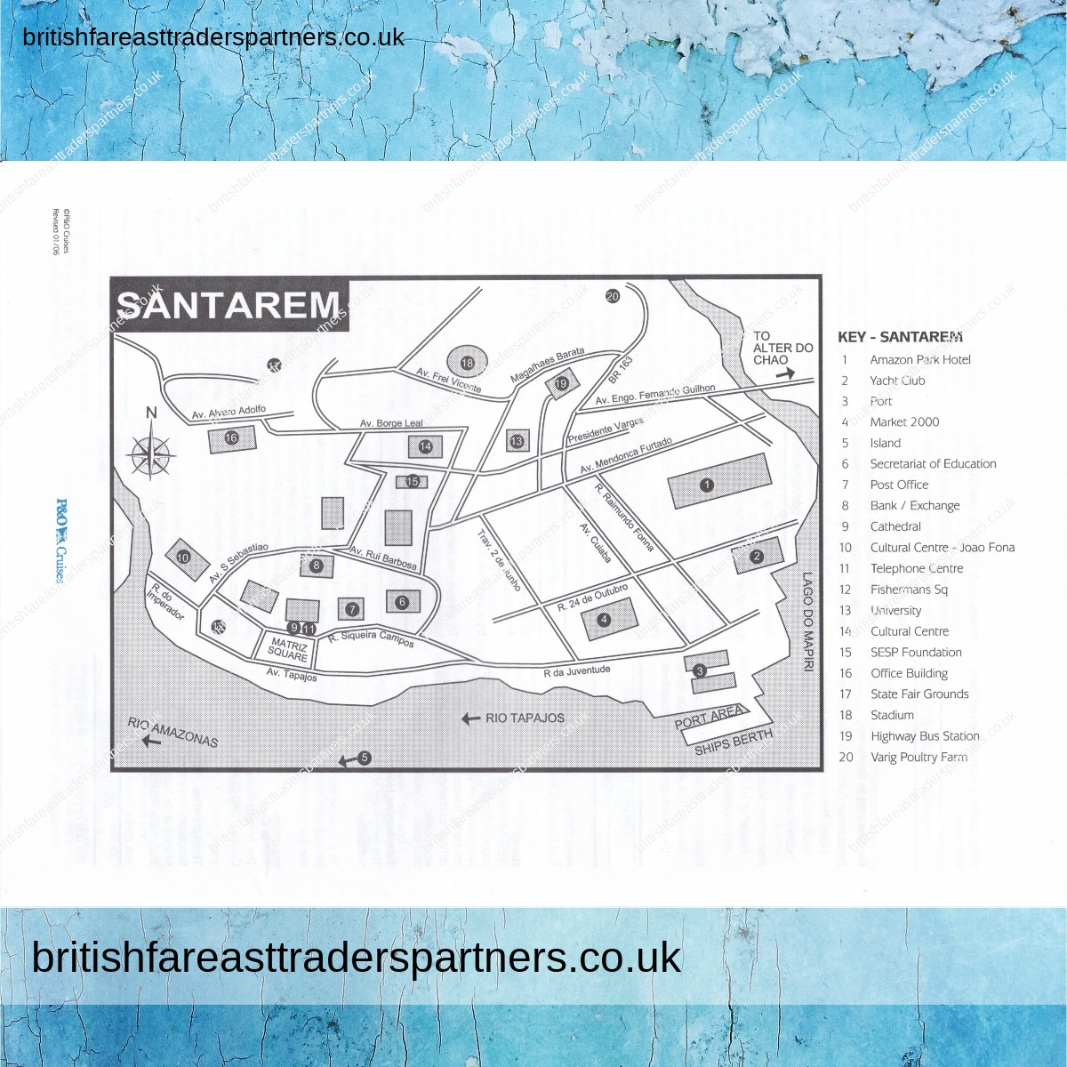
KEY- SANTAREM
1. Amazon Park Hotel
2. Yacht Club
3. Port
4. Market 2000
5. Island
6. Secretariat of Education
7. Post Office
8. Bank / Exchange
9. Cathedral
10. Cultural Centre – Joao Fona
11. Telephone Centre
12. Fishermans Sq
13. University
14. Cultural Centre
15. SESP Foundation
16. Office Building
17.State Fair Grounds
18. Stadium
19. Highway Bus Station
20. Varig Poultry Farm
NOTES / OTHER DETAILS:
INSIDE material (2 pages) not scanned.
Only FRONT & BACK material are scanned.
This will be posted to you as A5 / SMALL LETTER.
PREFERRED SHIPPING PARTNERS:
ROYAL MAIL UK
BRITISH & FAR EAST TRADERS LIFESTYLE & SHOPPING BLOG RELATED POSTS:
 DISCOVER THE TIMELESS VILLAGE OF CLOVELLY IN BIDEFORD, NORTH DEVON, ENGLAND, UNITED KINGDOM
 2005 P&O CRUISES DOMINICA (CARIBBEAN ISLANDS) PORT GUIDE LEAFLET
 VINTAGE Selection of CUNARD LINE ( CRUISES ) PORTS of CALL PORT GUIDES
 2003 LIMITED EDITION CORONATION ANNIVERSARY QUEEN ELIZABETH II INGOT STAMP COVER
 OLD (VINTAGE & ANTIQUES) Collectable POSTCARDS of LONDON and LONDON LIFE
 DAYS OUT IN UNITED KINGDOM: PLACES OF INTEREST in WEST SUSSEX, ENGLAND: A SERIES OF PHOTOGRAPHIC BLOG: ARUNDEL CASTLE GROUNDS & ARUNDEL CASTLE WATER GARDEN : A WORLD HERITAGE SITE : HERITAGE | ART | HISTORY | TOPOGRAPHY | TOURISM | TRAVEL | ARCHITECTURE | ARISTOCRACY | CULTURE
 DAYS OUT IN ENGLAND: PICTURESQUE BOXHILL, SURREY, ENGLAND
 SEND POSITIVE VIBES with OUR new range of COLOURFUL, VIBRANT, and ARTISTIC GREETING CARDS designed in the UNITED KINGDOM by INSPIRING UK ARTISTS: FEATURING BRITISH ARTIST KATHERINE WILLIAMS
 “Exploring a Glimpse of Queen Victoria’s Childhood: Antique Photos from The Sphere Magazine, January 26, 1901”
 VINTAGE 1991 CANBERRA P&O CRUISES COLLECTABLE CHRISTMAS DAY DINNER MENU
 “The Magnificent Collection of Reginald and Daisy Glazebrook: A Look into Sotheby’s Auction of 1994 at Brynbella, Tremeirchion”
 VINTAGE Marbled ONYX Egg on a Wooden Cup Desk / Table DECOR Paper Weight
 VINTAGE AMERICA 1982 TRANSATLANTIC HOLIDAYS: CITIES EAST AND WEST: DRIVE YOURSELF CRUISES: CUNARD CRUISES 23 PAGES COLOURFUL BROCHURE COLLECTABLES / SEA TRANSPORT / CRUISES / HOLIDAYS / NOSTALGIA / TOURS & TRAVELS / EPHEMERA
 VINTAGE SUNDAY 5TH SEPTEMBER 1982 CUNARD RMS Queen Elizabeth 2 ENTERTAINMENT SHEET / PROGRAMME BOB HAINES: CRUISE DIRECTOR / STEVE COCKING: ENTERTAINMENTS MANAGER COLLECTABLE NAUTICAL CRUISE SHIP / TRAVEL / HOLIDAYS HISTORICAL MEMORABILIA / SOUVENIR / EPHEMERA
 VINTAGE THURSDAY 9TH SEPTEMBER 1982 CUNARD CRUISES RMS Queen Elizabeth 2 A WORLD OF ENTERTAINMENT ENTERTAINMENT SHEET / DAILY PROGRAMME TODAY A CHANCE TO MEET: BARBARA GEARY / PETER GORDENO / JEFFREY & CHERYL DOBINSON COLLECTABLE NAUTICAL CRUISE SHIP / TRAVEL / HOLIDAYS HISTORICAL MEMORABILIA / SOUVENIR / EPHEMERA
 2005 P&O CRUISES MANAUS (BRAZIL) PORT GUIDE LEAFLET
 VINTAGE 1992 ‘THE DANIELLS IN INDIA” ART P&O CRUISES COLLECTABLE DINNER MENU
 “Discovering the Beauty and Heritage of Sussex: A Zen Walk from Friston Forest to Cuckmere Haven”
 VINTAGE FLINTSHIRE GENERAL CARGO SHIP by VAN DER GIESSEN (NETHERLANDS) PHOTO
 VINTAGE 1980 Famous People (Mrs. Gaskell) Post Office Picture Card
 VINTAGE QUEEN ELIZABETH II CUNARD CRUISES INFORMATION BOOKLET ENGLISH / FRANCAIS / DEUTSCH / ESPANOL/ COLLECTABLES / SEA TRANSPORT / CRUISES / HOLIDAYS / TOURS & TRAVELS / EPHEMERA
 SELECTION of Collectable P&O CRUISES PORTS of CALL PORT GUIDES
 Welcome to Blenheim Palace: Home to the Dukes of Marlborough and Childhood & Ancestral Home to Sir Winston Churchill
 2001 TOKYO JAPAN RED NIPPON PRINTED STAMP ON AEROGRAMME ENVELOPE COVER
 VINTAGE 1991 ‘STRATHAIRD 1932’ SHIPS OF THE P&O COLLECTABLE CRUISE DINNER MENU
 VINTAGE QUEEN ELIZABETH II FIRST CLASS IN A CLASS OF ITS OWN CUNARD CRUISES CUNARD MAGAZINE COLLECTABLES | SEA TRANSPORT | CRUISES | HOLIDAYS | LIFESTYLE TOURS & TRAVELS | EPHEMERA | ADVERTISING
 VINTAGE “CANNES Un coin du Port, le Quai St-Pierre et le Suquet FRANCE” POSTCARD
 VINTAGE MAY 4, 1935 GRACE CRUISES CRUISES BETWEEN NEW YORK AND CALIFORNIA ILLUSTRATED LONDON NEWS PRINT AD COLLECTABLES / SEA TRANSPORT | NAUTICAL | CRUISE SHIPS | OCEAN LINERS | HOLIDAYS | TOURS & TRAVELS | EPHEMERA
 VINTAGE Handpainted KUTANI JAPAN TRIO of CUP, SAUCER, and SMALL PLATE
 ‘RUNNING THE EASTING DOWN IN THE ROARING FORTIES’ MAURICE RANDALL SHIP POSTCARD